Overview
Remote sensing is one of the most important and widely applied methods for monitoring natural and built environments. Satellite images help society understand the atmospheric, terrestrial and aquatic environments of the earth. Information extracted from images may be used in many ways - as a basis for mapping and monitoring changes to features (vegetation communities, soil types, mineral outcrops) and biophysical properties (biomass of forest, crop yields, ozone concentration, soil moisture). Satellite images are often integrated into Geographic Information Systems (GIS) and with other spatial data to support environmental management. You will learn the spectral and spatial concepts that underpin multi-band image biophysical classification schemes. You will spend time practicing image acquisition, processing and interpretation steps. Given the continued proliferation of satellite and airborne vehicle acquired images for efficiently monitoring earth processes – remotely sensed image processing skills will increasingly be in demand.
Details
Pre-requisites or Co-requisites
Prerequisite: Minimum of 18 units of credit
Important note: Students enrolled in a subsequent unit who failed their pre-requisite unit, should drop the subsequent unit before the census date or within 10 working days of Fail grade notification. Students who do not drop the unit in this timeframe cannot later drop the unit without academic and financial liability. See details in the Assessment Policy and Procedure (Higher Education Coursework).
Offerings For Term 1 - 2019
Attendance Requirements
All on-campus students are expected to attend scheduled classes - in some units, these classes are identified as a mandatory (pass/fail) component and attendance is compulsory. International students, on a student visa, must maintain a full time study load and meet both attendance and academic progress requirements in each study period (satisfactory attendance for International students is defined as maintaining at least an 80% attendance record).
Recommended Student Time Commitment
Each 6-credit Undergraduate unit at CQUniversity requires an overall time commitment of an average of 12.5 hours of study per week, making a total of 150 hours for the unit.
Class Timetable
Assessment Overview
Assessment Grading
This is a graded unit: your overall grade will be calculated from the marks or grades for each assessment task, based on the relative weightings shown in the table above. You must obtain an overall mark for the unit of at least 50%, or an overall grade of 'pass' in order to pass the unit. If any 'pass/fail' tasks are shown in the table above they must also be completed successfully ('pass' grade). You must also meet any minimum mark requirements specified for a particular assessment task, as detailed in the 'assessment task' section (note that in some instances, the minimum mark for a task may be greater than 50%). Consult the University's Grades and Results Policy for more details of interim results and final grades.
All University policies are available on the CQUniversity Policy site.
You may wish to view these policies:
- Grades and Results Policy
- Assessment Policy and Procedure (Higher Education Coursework)
- Review of Grade Procedure
- Student Academic Integrity Policy and Procedure
- Monitoring Academic Progress (MAP) Policy and Procedure - Domestic Students
- Monitoring Academic Progress (MAP) Policy and Procedure - International Students
- Student Refund and Credit Balance Policy and Procedure
- Student Feedback - Compliments and Complaints Policy and Procedure
- Information and Communications Technology Acceptable Use Policy and Procedure
This list is not an exhaustive list of all University policies. The full list of University policies are available on the CQUniversity Policy site.
Feedback, Recommendations and Responses
Every unit is reviewed for enhancement each year. At the most recent review, the following staff and student feedback items were identified and recommendations were made.
Feedback from Student feedback.
Student feedback suggests the assessment instructions need to be clearer.
GEOG12021 assessment instructions will be re-written.
- Describe the electromagnetic radiation theory behind satellite monitoring of the earth
- Create maps of selected earth observation parameters using satellite image processing techniques
- Evaluate the limitations of satellite remote sensing image processing for an earth observation application
- Explain the concepts of spatial, spectral, radiometric and temporal resolutions of remotely sensed data
- Plan a project that requires analysis of remotely sensed data.
Nil
Alignment of Assessment Tasks to Learning Outcomes
| Assessment Tasks | Learning Outcomes | ||||
|---|---|---|---|---|---|
| 1 | 2 | 3 | 4 | 5 | |
| 1 - Practical and Written Assessment - 20% | |||||
| 2 - Practical and Written Assessment - 30% | |||||
| 3 - Case Study - 50% | |||||
Alignment of Graduate Attributes to Learning Outcomes
| Graduate Attributes | Learning Outcomes | ||||
|---|---|---|---|---|---|
| 1 | 2 | 3 | 4 | 5 | |
| 1 - Communication | |||||
| 2 - Problem Solving | |||||
| 3 - Critical Thinking | |||||
| 4 - Information Literacy | |||||
| 5 - Team Work | |||||
| 6 - Information Technology Competence | |||||
| 7 - Cross Cultural Competence | |||||
| 8 - Ethical practice | |||||
| 9 - Social Innovation | |||||
| 10 - First Nations Knowledges | |||||
| 11 - Aboriginal and Torres Strait Islander Cultures | |||||
Alignment of Assessment Tasks to Graduate Attributes
| Assessment Tasks | Graduate Attributes | ||||||||||
|---|---|---|---|---|---|---|---|---|---|---|---|
| 1 | 2 | 3 | 4 | 5 | 6 | 7 | 8 | 9 | 10 | 11 | |
| 1 - Practical and Written Assessment - 20% | |||||||||||
| 2 - Practical and Written Assessment - 30% | |||||||||||
| 3 - Case Study - 50% | |||||||||||
Textbooks
There are no required textbooks.
IT Resources
- CQUniversity Student Email
- Internet
- Unit Website (Moodle)
- European Space Agency Image Processing Software (students will be guided on where to get this software)
All submissions for this unit must use the referencing style: Harvard (author-date)
For further information, see the Assessment Tasks.
m.hewson@cqu.edu.au
Week 1
Begin Date: 11 Mar 2019Module/Topic
Solving Problems With Remote Sensing.
Chapter
Readings and resources will be provided by the lecturer each week in the GEOG12021 Moodle site.
Events and Submissions/Topic
Week 2
Begin Date: 18 Mar 2019Module/Topic
Electromagnetic Radiation: Properties & Interactions.
Chapter
Events and Submissions/Topic
Week 3
Begin Date: 25 Mar 2019Module/Topic
Multi-Spectral Passive Sensors.
Chapter
Events and Submissions/Topic
Week 4
Begin Date: 01 Apr 2019Module/Topic
Multi-spectral Sensor Data-sets.
Chapter
Events and Submissions/Topic
Week 5
Begin Date: 08 Apr 2019Module/Topic
Image Interpretation & Analysis.
Chapter
Events and Submissions/Topic
Vacation Week
Begin Date: 15 Apr 2019Module/Topic
Chapter
Events and Submissions/Topic
Week 6
Begin Date: 22 Apr 2019Module/Topic
Image Processing Fundamentals.
Chapter
Events and Submissions/Topic
Week 7
Begin Date: 29 Apr 2019Module/Topic
Image Pre-Processing.
Chapter
Events and Submissions/Topic
Week 8
Begin Date: 06 May 2019Module/Topic
Image Analysis Part 1.
Chapter
Events and Submissions/Topic
Week 9
Begin Date: 13 May 2019Module/Topic
Image Analysis Part 2.
Chapter
Events and Submissions/Topic
Week 10
Begin Date: 20 May 2019Module/Topic
Image Post-processing.
Chapter
Events and Submissions/Topic
Week 11
Begin Date: 27 May 2019Module/Topic
High Spatial and Spectral Resolution Image Processing.
Chapter
Events and Submissions/Topic
Week 12
Begin Date: 03 Jun 2019Module/Topic
Active Sensor Systems – Radar & Lidar.
Chapter
Events and Submissions/Topic
Review/Exam Week
Begin Date: 10 Jun 2019Module/Topic
Chapter
Events and Submissions/Topic
Exam Week
Begin Date: 17 Jun 2019Module/Topic
Chapter
Events and Submissions/Topic
1 Practical and Written Assessment
Portfolio #1 is a submission of some short answer questions, worked exercises and the result of image processing exercises. A GEOG12021 Moodle site provides detailed assessment task instructions.
Week 4 Wednesday (3 Apr 2019) 11:00 pm AEST
Week 5 Friday (12 Apr 2019)
A GEOG12021 Moodle site also provides detailed marking criteria – a synopsis of which is:
- completeness of the short answer questions concerning the learning material;
- within word limits;
- sentence construction, argument structure and readability of the short answer;
- the degree to which the image processing or worked task fulfils the aim of the exercise; and
- Suitable image presentation standards appropriate to the stage of learning.
- Describe the electromagnetic radiation theory behind satellite monitoring of the earth
- Communication
- Information Literacy
- Information Technology Competence
2 Practical and Written Assessment
Portfolio #2 is a submission of some short answer questions, worked exercises and the result of image processing exercises. A GEOG12021 Moodle site provides detailed assessment task instructions.
Week 7 Wednesday (1 May 2019) 11:00 pm AEST
Week 8 Friday (10 May 2019)
A GEOG12021 Moodle site also provides detailed marking criteria – a synopsis of which is:
- completeness of the short answer questions concerning the learning material;
- within word limits;
- sentence construction, argument structure and readability of the short answer;
- the degree to which the image processing or worked task fulfils the aim of the exercise; and
- Suitable image presentation standards appropriate to the stage of learning.
- Explain the concepts of spatial, spectral, radiometric and temporal resolutions of remotely sensed data
- Communication
- Information Literacy
- Information Technology Competence
3 Case Study
Portfolio #3 is a submission of some short answer questions, worked exercises and the result of image processing exercises. A GEOG12021 Moodle site provides detailed assessment task instructions.
Week 12 Wednesday (5 June 2019) 11:00 pm AEST
Review/Exam Week Friday (14 June 2019)
A GEOG12021 Moodle site also provides detailed marking criteria – a synopsis of which is:
- completeness of the short answer questions concerning the learning material;
- within word limits;
- sentence construction, argument structure and readability of the short answer;
- the degree to which the image processing or worked task fulfils the aim of the exercise; and
- Suitable image presentation standards appropriate to the stage of learning.
- Create maps of selected earth observation parameters using satellite image processing techniques
- Evaluate the limitations of satellite remote sensing image processing for an earth observation application
- Plan a project that requires analysis of remotely sensed data.
- Communication
- Problem Solving
- Critical Thinking
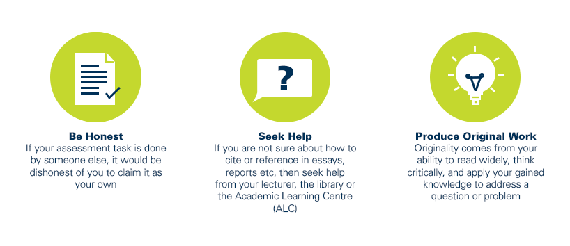
As a CQUniversity student you are expected to act honestly in all aspects of your academic work.
Any assessable work undertaken or submitted for review or assessment must be your own work. Assessable work is any type of work you do to meet the assessment requirements in the unit, including draft work submitted for review and feedback and final work to be assessed.
When you use the ideas, words or data of others in your assessment, you must thoroughly and clearly acknowledge the source of this information by using the correct referencing style for your unit. Using others’ work without proper acknowledgement may be considered a form of intellectual dishonesty.
Participating honestly, respectfully, responsibly, and fairly in your university study ensures the CQUniversity qualification you earn will be valued as a true indication of your individual academic achievement and will continue to receive the respect and recognition it deserves.
As a student, you are responsible for reading and following CQUniversity’s policies, including the Student Academic Integrity Policy and Procedure. This policy sets out CQUniversity’s expectations of you to act with integrity, examples of academic integrity breaches to avoid, the processes used to address alleged breaches of academic integrity, and potential penalties.
What is a breach of academic integrity?
A breach of academic integrity includes but is not limited to plagiarism, self-plagiarism, collusion, cheating, contract cheating, and academic misconduct. The Student Academic Integrity Policy and Procedure defines what these terms mean and gives examples.
Why is academic integrity important?
A breach of academic integrity may result in one or more penalties, including suspension or even expulsion from the University. It can also have negative implications for student visas and future enrolment at CQUniversity or elsewhere. Students who engage in contract cheating also risk being blackmailed by contract cheating services.
Where can I get assistance?
For academic advice and guidance, the Academic Learning Centre (ALC) can support you in becoming confident in completing assessments with integrity and of high standard.
What can you do to act with integrity?