Overview
Geographic Information Systems (GIS) power decision making for a massive raft of earth and human system interactions in research, government and industry – far beyond the cartographic public face that is Google maps. You will be gain introductory practical skill in making electronic maps and analysing geographical data. You will explore key mapping concepts that underpin GIS, as well as practice some of the key map communication standards that are as important today as they were for Geradus Mercator in the 16th century.
Details
Pre-requisites or Co-requisites
Prerequisite: Minimum of 18 Units of Credit
Important note: Students enrolled in a subsequent unit who failed their pre-requisite unit, should drop the subsequent unit before the census date or within 10 working days of Fail grade notification. Students who do not drop the unit in this timeframe cannot later drop the unit without academic and financial liability. See details in the Assessment Policy and Procedure (Higher Education Coursework).
Offerings For Term 1 - 2020
Attendance Requirements
All on-campus students are expected to attend scheduled classes - in some units, these classes are identified as a mandatory (pass/fail) component and attendance is compulsory. International students, on a student visa, must maintain a full time study load and meet both attendance and academic progress requirements in each study period (satisfactory attendance for International students is defined as maintaining at least an 80% attendance record).
Recommended Student Time Commitment
Each 6-credit Undergraduate unit at CQUniversity requires an overall time commitment of an average of 12.5 hours of study per week, making a total of 150 hours for the unit.
Class Timetable
Assessment Overview
Assessment Grading
This is a graded unit: your overall grade will be calculated from the marks or grades for each assessment task, based on the relative weightings shown in the table above. You must obtain an overall mark for the unit of at least 50%, or an overall grade of 'pass' in order to pass the unit. If any 'pass/fail' tasks are shown in the table above they must also be completed successfully ('pass' grade). You must also meet any minimum mark requirements specified for a particular assessment task, as detailed in the 'assessment task' section (note that in some instances, the minimum mark for a task may be greater than 50%). Consult the University's Grades and Results Policy for more details of interim results and final grades.
All University policies are available on the CQUniversity Policy site.
You may wish to view these policies:
- Grades and Results Policy
- Assessment Policy and Procedure (Higher Education Coursework)
- Review of Grade Procedure
- Student Academic Integrity Policy and Procedure
- Monitoring Academic Progress (MAP) Policy and Procedure - Domestic Students
- Monitoring Academic Progress (MAP) Policy and Procedure - International Students
- Student Refund and Credit Balance Policy and Procedure
- Student Feedback - Compliments and Complaints Policy and Procedure
- Information and Communications Technology Acceptable Use Policy and Procedure
This list is not an exhaustive list of all University policies. The full list of University policies are available on the CQUniversity Policy site.
Feedback, Recommendations and Responses
Every unit is reviewed for enhancement each year. At the most recent review, the following staff and student feedback items were identified and recommendations were made.
Feedback from Student feedback.
Students indicate learning ESRI ArcGIS in distance mode is a challenging assignment - with textbook costs, Microsoft Windows-centric software and IT issues causing frustration.
The unit coordinator agrees that teaching sophisticated software skill acquisition via distance education is not ideal. After 2021 the unit coordinator plans to transition the learning material from ArcGIS Desktop to ArcGIS-online thus allowing access to the system for Mac and Windows users.
- Explain how earth measurement theory underpins the production of electronic maps;
- Replicate a range of GIS mapping operations using point, line, polygon and raster data samples;
- Reproduce GIS based maps that meet cartographic theory, standards and practice;
- Solve introductory spatial analysis problems using GIS data management and manipulation functions.
Nil
Alignment of Assessment Tasks to Learning Outcomes
| Assessment Tasks | Learning Outcomes | |||
|---|---|---|---|---|
| 1 | 2 | 3 | 4 | |
| 1 - Practical Assessment - 10% | ||||
| 2 - Practical Assessment - 15% | ||||
| 3 - Practical Assessment - 20% | ||||
| 4 - Practical Assessment - 25% | ||||
| 5 - Practical Assessment - 30% | ||||
Alignment of Graduate Attributes to Learning Outcomes
| Graduate Attributes | Learning Outcomes | |||
|---|---|---|---|---|
| 1 | 2 | 3 | 4 | |
| 1 - Communication | ||||
| 2 - Problem Solving | ||||
| 3 - Critical Thinking | ||||
| 4 - Information Literacy | ||||
| 5 - Team Work | ||||
| 6 - Information Technology Competence | ||||
| 7 - Cross Cultural Competence | ||||
| 8 - Ethical practice | ||||
| 9 - Social Innovation | ||||
| 10 - First Nations Knowledges | ||||
| 11 - Aboriginal and Torres Strait Islander Cultures | ||||
Alignment of Assessment Tasks to Graduate Attributes
| Assessment Tasks | Graduate Attributes | ||||||||||
|---|---|---|---|---|---|---|---|---|---|---|---|
| 1 | 2 | 3 | 4 | 5 | 6 | 7 | 8 | 9 | 10 | 11 | |
| 1 - Practical Assessment - 10% | |||||||||||
| 2 - Practical Assessment - 15% | |||||||||||
| 3 - Practical Assessment - 20% | |||||||||||
| 4 - Practical Assessment - 25% | |||||||||||
| 5 - Practical Assessment - 30% | |||||||||||
Textbooks
Getting to Know ArcGIS Desktop
- Edition: 5 (2018)
- Authors: Michael Law, Amy Collins
- ESRI Press
- Redlands Redlands , California , The United States of America
- ISBN: 9781589485105
- Binding: Paperback
Additional Textbook Information
The student must read the unit profile for specific details around the textbook purchase.
Copies are available for purchase at the CQUni Bookshop here: http://bookshop.cqu.edu.au (search on the Unit code)
IT Resources
- CQUniversity Student Email
- Internet
- Unit Website (Moodle)
- A personal computer with Windows 7 or 10 to use the ArcGIS software. ArcGIS does not run on Apple hardware. Contact the unit co-ordinator if this constitutes a difficulty.
All submissions for this unit must use the referencing style: Harvard (author-date)
For further information, see the Assessment Tasks.
m.hewson@cqu.edu.au
Week 1
Begin Date: 09 Mar 2020Module/Topic
Introduction to Geographic Information Systems (GIS)
Chapter
Selected maps, videos and readings will be made available supplementing the prescribed textbook learning activities for each of the following weeks.
Events and Submissions/Topic
Week 2
Begin Date: 16 Mar 2020Module/Topic
Digital Maps and GIS
Chapter
Events and Submissions/Topic
Week 3
Begin Date: 23 Mar 2020Module/Topic
Interacting with Geographic Data
Chapter
Events and Submissions/Topic
Week 4
Begin Date: 30 Mar 2020Module/Topic
Geographic Co-ordinate Systems and Projections
Chapter
Events and Submissions/Topic
Week 5
Begin Date: 06 Apr 2020Module/Topic
Mapping Features – Symbols, Labels and Classification
Chapter
Events and Submissions/Topic
Vacation Week
Begin Date: 13 Apr 2020Module/Topic
Vacation week
Chapter
Events and Submissions/Topic
Week 6
Begin Date: 20 Apr 2020Module/Topic
Cartography
Chapter
Events and Submissions/Topic
Week 7
Begin Date: 27 Apr 2020Module/Topic
Creating and Editing Features
Chapter
Events and Submissions/Topic
Week 8
Begin Date: 04 May 2020Module/Topic
Geographical Answers – Querying and Selecting Features
Chapter
Events and Submissions/Topic
Week 9
Begin Date: 11 May 2020Module/Topic
Geographical Answers – Relating Data
Chapter
Events and Submissions/Topic
Week 10
Begin Date: 18 May 2020Module/Topic
Geographical Answers – Spatial Analysis - Vector Data
Chapter
Events and Submissions/Topic
Week 11
Begin Date: 25 May 2020Module/Topic
Geographical Answers – Spatial Analysis - Raster Data
Chapter
Events and Submissions/Topic
Week 12
Begin Date: 01 Jun 2020Module/Topic
Spatial Systems - Emerging Trends
Chapter
Events and Submissions/Topic
Review/Exam Week
Begin Date: 08 Jun 2020Module/Topic
Chapter
Events and Submissions/Topic
Exam Week
Begin Date: 15 Jun 2020Module/Topic
Chapter
Events and Submissions/Topic
The unit learning activities and assessment relies entirely on the textbook provided ‘key’ that allows the student to download a time limited, trial edition of ESRI ArcGIS as well as the essential exercise data.
You must obtain a new version of the prescribed text book as quickly as possible.
A second hand textbook does not contain the essential coded ‘key’ (it was used by any previous owner). Further, any textbook edition other than edition noted will not provide the student with the correct materials for the assessment of this unit.
Students are required to have access to a personal computer using Microsoft Windows. ArcGIS will not easily run in an Apple environment. If this requirement constitutes a difficulty, you should contact the unit co-ordinator as soon as possible. You could access ArcGIS at a CQU campus near you. It is important to note that ArcGIS is a sophisticated software system and it requires a reasonably current PC on which to run.
Students are expected to have a working knowledge of file handling in Microsoft Windows including the File Manager.
1 Practical Assessment
Portfolio #1 has two components:
(1) Short answer questions; and
(2) GIS map output (being the result of undertaking the learning activities).
The material being assessed in Portfolio #1 comes from the learning activities of weeks 2 and 3 of the unit tuition.
The portfolio will be submitted via Moodle as a single *.pdf file - the GEOG19021 Moodle site will only allow PDF file submission.
Submit only the requested portfolio answers. They are a clearly identified subset of the exercises you undertake each week – do not submit all the weekly learning activity.
Week 4 Friday (3 Apr 2020) 11:00 pm AEST
Submit Portfolio #1 via the GEOG19021 Moodle site.
Vacation Week Friday (17 Apr 2020)
Feedback will be returned via the GEOG19021 Moodle site.
The assessment standards and marking criteria are further described in the GEOG19021 Moodle site – in summary:
1. Short answers:
· correct answer;
· completeness of discussion with respect to the learning material;
· within word limits; and
· sentence construction, argument structure and readability of the short answer.
2. GIS maps:
· completeness of the maps with respect to the learning material and the context of the instructions of the textbook;
· compliance with cartographic standards (relevant to Portfolio);
· map extent scaled suitably to address the question; and
· how the map "tells the story" to the map readership.
Marks will be deducted at a rate of 1 mark for every 24 hours that the submission is later than the due or approved extension date/time.
Marks may be deducted if the maps are difficult to read – this includes poor choices for formatting legends, symbols/labels or map choropleths (colour design).
- Explain how earth measurement theory underpins the production of electronic maps;
- Replicate a range of GIS mapping operations using point, line, polygon and raster data samples;
- Reproduce GIS based maps that meet cartographic theory, standards and practice;
- Solve introductory spatial analysis problems using GIS data management and manipulation functions.
- Communication
- Problem Solving
- Critical Thinking
- Information Literacy
- Information Technology Competence
2 Practical Assessment
Portfolio #2 has two components:
(1) Short answer questions; and
(2) GIS map output (being the result of undertaking the learning activities).
The material being assessed in Portfolio #2 comes from the learning activities of weeks 4 and 5 of the unit tuition.
The portfolio will be submitted via Moodle as a single *.pdf file - the GEOG19021 Moodle site will only allow PDF file submission.
Submit only the requested portfolio answers. They are a clearly identified subset of the exercises you undertake each week – do not submit all the weekly learning activity.
Week 6 Friday (24 Apr 2020) 11:00 pm AEST
Submit Portfolio #2 via the GEOG19021 Moodle site.
Week 8 Friday (8 May 2020)
Feedback will be returned via the GEOG19021 Moodle site.
The assessment standards and marking criteria are further described in the GEOG19021 Moodle site – in summary:
1. Short answers:
· correct answer;
· completeness of discussion with respect to the learning material;
· within word limits; and
· sentence construction, argument structure and readability of the short answer.
2. GIS maps:
· completeness of the maps with respect to the learning material and the context of the instructions of the textbook;
· compliance with cartographic standards (relevant to Portfolio);
· map extent scaled suitably to address the question; and
· how the map "tells the story" to the map readership.
Marks will be deducted at a rate of 1 mark for every 24 hours that the submission is later than the due or approved extension date/time.
Marks may be deducted if the maps are difficult to read – this includes poor choices for formatting legends, symbols/labels or map choropleths (colour design).
- Explain how earth measurement theory underpins the production of electronic maps;
- Replicate a range of GIS mapping operations using point, line, polygon and raster data samples;
- Reproduce GIS based maps that meet cartographic theory, standards and practice;
- Solve introductory spatial analysis problems using GIS data management and manipulation functions.
- Communication
- Problem Solving
- Critical Thinking
- Information Literacy
- Information Technology Competence
3 Practical Assessment
Portfolio #3 has two components:
(1) Short answer questions; and
(2) GIS map output (being the result of undertaking the learning activities).
The material being assessed in Portfolio #3 comes from the learning activities of weeks 6 and 7 of the unit tuition.
The portfolio will be submitted via Moodle as a single *.pdf file - the GEOG19021 Moodle site will only allow PDF file submission.
Submit only the requested portfolio answers. They are a clearly identified subset of the exercises you undertake each week – do not submit all the weekly learning activity.
Week 8 Monday (4 May 2020) 11:00 pm AEST
Submit Portfolio #3 via the GEOG19021 Moodle site.
Week 10 Monday (18 May 2020)
Feedback will be returned via the GEOG19021 Moodle site.
The assessment standards and marking criteria are further described in the GEOG19021 Moodle site – in summary:
1. Short answers:
· correct answer;
· completeness of discussion with respect to the learning material;
· within word limits; and
· sentence construction, argument structure and readability of the short answer.
2. GIS maps:
· completeness of the maps with respect to the learning material and the context of the instructions of the textbook;
· compliance with cartographic standards (relevant to Portfolio);
· map extent scaled suitably to address the question; and
· how the map "tells the story" to the map readership.
Marks will be deducted at a rate of 1 mark for every 24 hours that the submission is later than the due or approved extension date/time.
Marks may be deducted if the maps are difficult to read – this includes poor choices for formatting legends, symbols/labels or map choropleths (colour design).
- Explain how earth measurement theory underpins the production of electronic maps;
- Replicate a range of GIS mapping operations using point, line, polygon and raster data samples;
- Reproduce GIS based maps that meet cartographic theory, standards and practice;
- Solve introductory spatial analysis problems using GIS data management and manipulation functions.
- Communication
- Problem Solving
- Critical Thinking
- Information Literacy
- Information Technology Competence
4 Practical Assessment
Portfolio #4 is a map production project based on lecturer provided data and a written statement of requirements. The detailed requirements for the map are provided in the GEOG19021 Moodle site. You will download a range of mapping input data files, construct the map to meet ‘user’ requirements and complete the map according to cartographic standards. Portfolio #4 is therefore different to Portfolios 1, 2, 3 and 5.
You will apply the learning of the unit to producing a single map – and you will be making some map design and content decisions guided by the task brief lodged in Moodle.
Week 10 Monday (18 May 2020) 11:00 pm AEST
Submit Portfolio #4 via the GEOG19021 Moodle site.
Week 12 Monday (1 June 2020)
Feedback will be returned via the GEOG19021 Moodle site.
The assessment standards and marking criteria are further described in the GEOG19021 Moodle site – in summary the single GIS map output will be assessed on:
- completeness of the maps with respect to the task brief noting the ‘user’ requirements.
- compliance with cartographic standards; and
- map extent scaled suitably to address the question and
- "tells the story" effectively to the map readership.
Marks will be deducted at a rate of 1 mark within every 24 hours that the submission is later than the due or approved extension date/time. For example - an assessment submitted 16 hours after the due date/time will be penalised 1 mark – at 32 hours, 2 marks and so on.
Marks may be deducted if the maps are difficult to read – this includes poor choices for map extent, formatting legends, symbols/labels or map choropleths (colour design).
- Explain how earth measurement theory underpins the production of electronic maps;
- Replicate a range of GIS mapping operations using point, line, polygon and raster data samples;
- Reproduce GIS based maps that meet cartographic theory, standards and practice;
- Solve introductory spatial analysis problems using GIS data management and manipulation functions.
- Communication
- Problem Solving
- Critical Thinking
- Information Literacy
- Information Technology Competence
5 Practical Assessment
Portfolio #5 has two components:
(1) Short answer questions; and
(2) GIS map output (being the result of undertaking the learning activities).
The material being assessed in Portfolio #5 comes from the learning activities of weeks 8, 9, 10 and 11 of the unit tuition.
The portfolio will be submitted via Moodle as a single *.pdf file - the GEOG19021 Moodle site will only allow PDF file submission.
Submit only the requested portfolio answers. They are a clearly identified subset of the exercises you undertake each week – do not submit all the weekly learning activity.
Submit Portfolio #5 via the GEOG19021 Moodle site.
Feedback will be returned via the GEOG19021 Moodle site.
Review/Exam Week Friday (12 June 2020) 11:00 pm AEST
Submit Portfolio #5 via the GEOG19021 Moodle site.
Exam Week Friday (19 June 2020)
Feedback will be returned via the GEOG19021 Moodle site.
The assessment standards and marking criteria are further described in the GEOG19021 Moodle site – in summary:
1. Short answers:
· correct answer;
· completeness of discussion with respect to the learning material;
· within word limits; and
· sentence construction, argument structure and readability of the short answer.
2. GIS maps:
· completeness of the maps with respect to the learning material and the context of the instructions of the textbook;
· compliance with cartographic standards (relevant to Portfolio);
· map extent scaled suitably to address the question; and
· how the map "tells the story" to the map readership.
Marks will be deducted at a rate of 1 mark for every 24 hours that the submission is later than the due or approved extension date/time.
Marks may be deducted if the maps are difficult to read – this includes poor choices for formatting legends, symbols/labels or map choropleths (colour design).
- Explain how earth measurement theory underpins the production of electronic maps;
- Replicate a range of GIS mapping operations using point, line, polygon and raster data samples;
- Reproduce GIS based maps that meet cartographic theory, standards and practice;
- Solve introductory spatial analysis problems using GIS data management and manipulation functions.
- Communication
- Problem Solving
- Critical Thinking
- Information Literacy
- Information Technology Competence
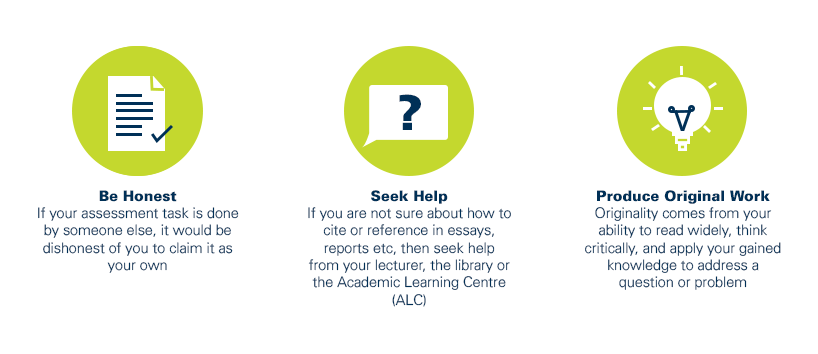
As a CQUniversity student you are expected to act honestly in all aspects of your academic work.
Any assessable work undertaken or submitted for review or assessment must be your own work. Assessable work is any type of work you do to meet the assessment requirements in the unit, including draft work submitted for review and feedback and final work to be assessed.
When you use the ideas, words or data of others in your assessment, you must thoroughly and clearly acknowledge the source of this information by using the correct referencing style for your unit. Using others’ work without proper acknowledgement may be considered a form of intellectual dishonesty.
Participating honestly, respectfully, responsibly, and fairly in your university study ensures the CQUniversity qualification you earn will be valued as a true indication of your individual academic achievement and will continue to receive the respect and recognition it deserves.
As a student, you are responsible for reading and following CQUniversity’s policies, including the Student Academic Integrity Policy and Procedure. This policy sets out CQUniversity’s expectations of you to act with integrity, examples of academic integrity breaches to avoid, the processes used to address alleged breaches of academic integrity, and potential penalties.
What is a breach of academic integrity?
A breach of academic integrity includes but is not limited to plagiarism, self-plagiarism, collusion, cheating, contract cheating, and academic misconduct. The Student Academic Integrity Policy and Procedure defines what these terms mean and gives examples.
Why is academic integrity important?
A breach of academic integrity may result in one or more penalties, including suspension or even expulsion from the University. It can also have negative implications for student visas and future enrolment at CQUniversity or elsewhere. Students who engage in contract cheating also risk being blackmailed by contract cheating services.
Where can I get assistance?
For academic advice and guidance, the Academic Learning Centre (ALC) can support you in becoming confident in completing assessments with integrity and of high standard.
What can you do to act with integrity?